|
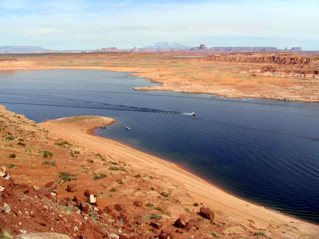
The first full day on Lake Powell, it had its
best colors out to greet me; little did I know what the lake was
planning for this week in March for Sacagawea.
The water level was about 100 feet below normal pool
level of 3700 feet, and a portion of the lake and its upper canyon
areas are dry. Lake Powell is at its lowest in March, when
the spring runoffs begin and the lake level starts to rise. The
Colorado River Basin is now loaded with snow and a good year for
higher water levels is expected.
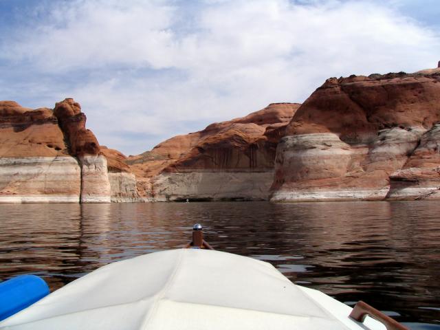
Castle Rock Cut was completely dry so I followed the main channel
from Wahweap Marina to Anchovy Point, the channel narrowed after
Anchovy Point causing some rough water due to the narrowness and
other boats for about two miles. Following the main channel buoy's
north and west of Padre Butte I cruised at 12 mph taking in this
awesome lake. That first day I traveled 37 miles exploring Padre
Bay and Last Chance Bay.
 |
Channel
from marina |
 |
Anchovy
Point left and dam to right |
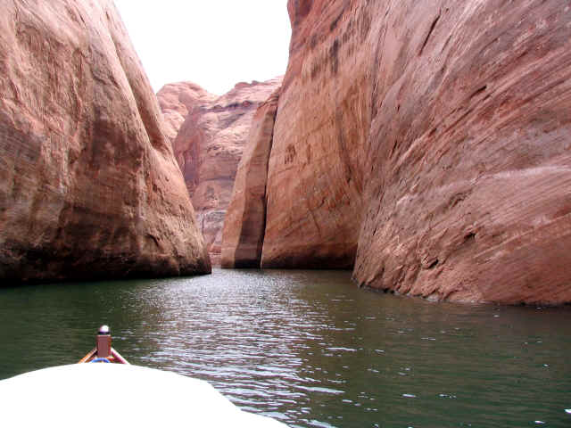
I located several good side canyons in Rock Creek Bay to spend
the night. Anchoring on solid rock or very then sand was not
working. The weather was changing to light rain and a wind form
the northwest. I found a narrow and low slot between some
large rocks with a small beach. I hauled the bow anchor up and
around a large boulder. By this time the wind was blowing about 15
mph from the port side of Sacagawea and I quickly hopped back in
the boat and secured a second line to the rear cleat and carried
it out to the north side of the slot and found another large
boulder. I also secured the second anchor line from the rear cleat
on the port side in a crack in some rocks. The rain and wind
lasted about 7 hours and the lines pulled and jerked but I was
snug inside Sacagawea for my first night on the lake. I used about
300 feet of line for the three points and was glad to have the
extra line on board.
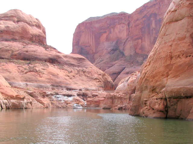
At first light, after a hot breakfast of Spam and eggs, I
retrieved the lines. With light winds from the south I headed out
of Friendship Cove in Rock Creek Bay for Dangling Rope Marina. I
topped off the gas and headed for Rainbow Bridge about 7 miles
from the Marina.
 |
Dangling Rope |
 |
Entrance to Forbidding Canyon |
Rainbow Bridge is about 2.5 miles inside the canyon, but with
current water levels, I walked the last 1.5 miles from the
docks where the water ended.
The only boat at the dock was a tour boat from Wahweap marina.
The captain helped me dock as he looked over Sacagawea. He
liked the boat and we talked about the the weather
coming in the next 12 hours. He warned me about the rain, snow and
high winds. I decided to spend the rest of the day hiking around
the canyon and Rainbow Bridge and spent the night tied to the
dock. I don't think you are allowed to camp or overnight on the
dock but I never saw another boat the rest of the day and night.
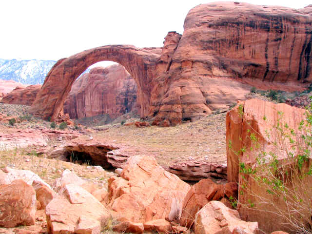
Rainbow Bridge National Monument is located approximately 50 miles
up-lake from Glen Canyon Dam in Forbidding Canyon. This awesome
span is the world's largest natural bridge standing 290 feet high.
Look for the people at the bottom left side of the bridge to
understand the size of Rainbow Bridge.
The day grew chilly as I returned to the boat and
added two more lines to secure the boat for the night. After a hot
dinner of chicken noodle soup and crackers I watch the shadow of
night engulf the canyon as the thunderstorm struck. Rain fell
hard; the wind blew up the canyon and sometimes down the canyon. The dock was a good place to be on this night. Morning
brought more rain and a tailwind as I headed out of
Forbidding Canyon toward the San Juan River Arm of the lake.
|